WHAT WE DO:

IMMERSIVE INTERACTIVE VIRTUAL BUILDINGS TOURS | 3D VIRTUAL CONDITION SURVEYS | 3D VIRTUAL DOCUMENTATION OF CULTURAL HERITAGE | INTERNAL AS BUILT/BUILDING INFORMATION MODELS (BIM)

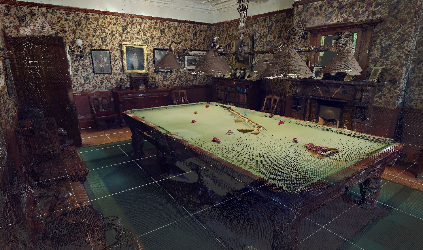
Virtual tours for marketing and engagement

Using our high tech scanning equipment we can produce high quality interactive 3D virtual building tours. These tours can be viewed in virtual reality and give the viewer a unique experience being immersed in the building as if they were there. Tours can be used as a visual online marketing tool for businesses to showcase their amenities, accommodation or products, examples include wedding venues where a room layouts can be viewed online prior to the prospective customer visiting the venue, they could even book the venue online via the virtual tour! The tours can be embedded in websites just like a video and with the click of a button shared via social media!

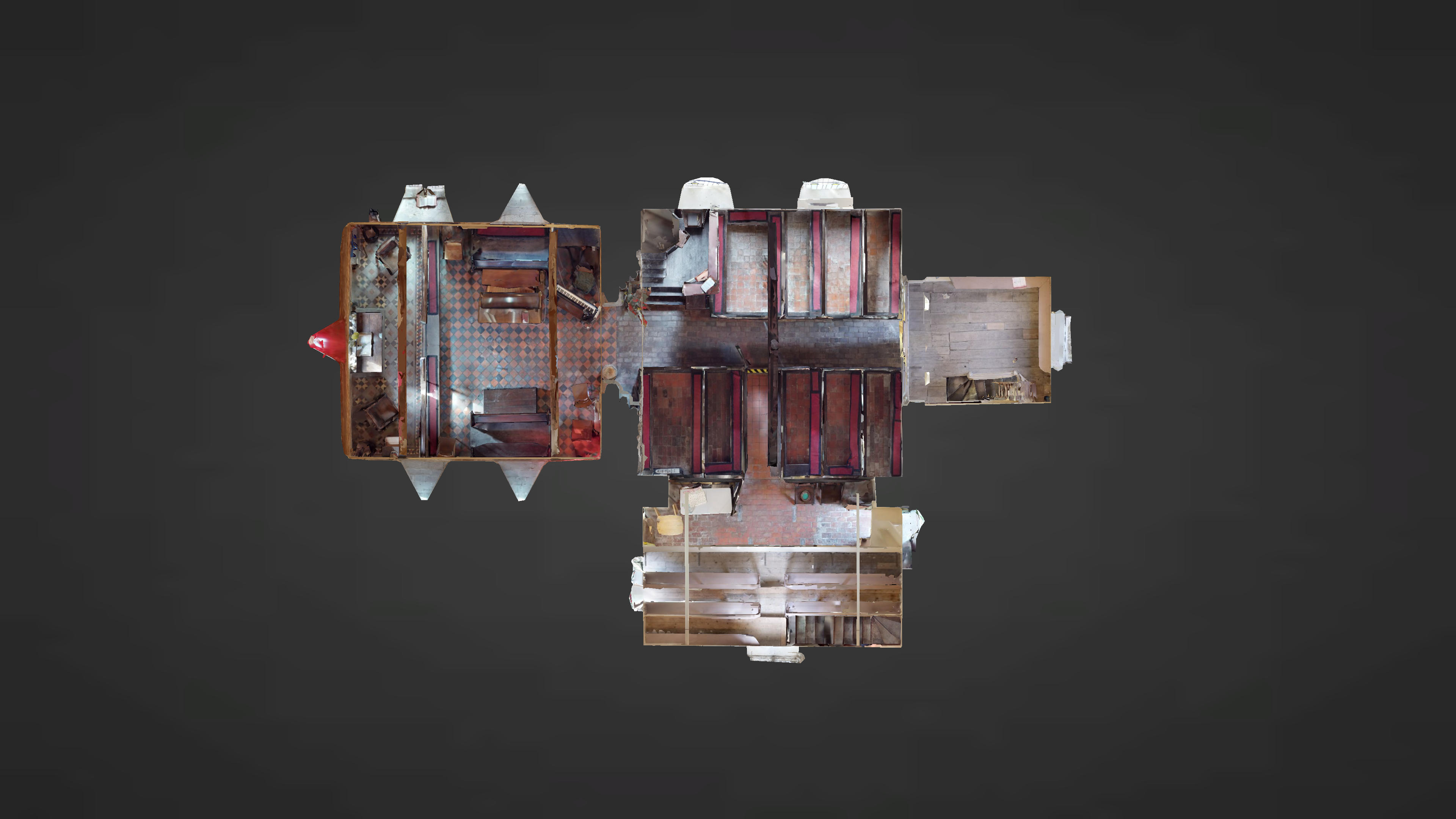
The tours have a unique 3D ‘dollhouse’ view which enables the viewer to see a building from various angles to gain an accurate insight into the layout and various features/rooms of the building. Information text and media can be embedded via tags i.e. videos, photographs, sounds and links to other websites. Other features include; individual high quality 4K photos, 360 panoramic snapshots and marketing videos and that can be shared via social media and for even more customer engagement the final tour can be published onto Google Street View, Google Maps and Google Earth.

Uses for the built environment and construction industry

Aside for the great uses above the tours have a number of uses for the built environment and construction industry. For example:

Historical research – as an Interpretation and a condition monitoring tool.

Condition surveys.

Dilapidation surveys.

Displaying areas that have public access restrictions i.e. old ruins that are unsafe to access.

Site progress tours.

Site safety tours.

Additionally we can provide the following assets/files from the tour:

colourised point clouds

reflected ceiling plan image

high resolution floor plan image

(.JPG) multiple files if multiple floors

(.PDF) all floors in one file

3D mesh file (.OBJ)

These assets/files can be used by a range of disciplines and can be imported into a variety of third-party programs to perform additional work. For example Architects and engineers can use the point cloud to jump-start their designs.

Please note the 3D data is accurate to within 1% of reality.

Aerial Support for Planning Appeals and Enforcement

Drone flight can reach even the most inaccessible, hazardous or large-scale sites to provide support for Planning Appeals and Enforcement.


Aerial Photogrammetry, 3D modelling & visualisation

Interactive photo-realistic 3D point-cloud and mesh models

Virtual reality

Architectural visualisation

UAV Drone aerial photography and video

Site progress photographs

Marketing Videos

Events

UAV drone aerial inspection, mapping & survey

Georeferenced orthomosaic

Digital terrain models (DTM)

Digital surface models (DSM)

Distances, areas and volumetric measurements

Contour and topographic mapping